Hiking the Maroon Bells Part 2
JoshuaHunterDavis Hikes

When I moved to Colorado, just a few short long years ago and began to embark on my journey as a serious Colorado hiker (or extremely half-assed mountaineer, I'm still trying to decide which it is), I quickly learned about and set my sights on an exceedingly popular and phenomenal hike known as the Four Pass Loop. Situated within the Maroon Bells-Snowmass Wilderness area of the White River National Forest, it's a stunning journey up and over four passes, as the name implies, that encircle the two behemoths that are the Maroon Bells mountains. This is not an area that the Colorado Trail or the Continental Divide Trail pass through, so it was virgin territory for me, and all that I really knew about them before moving to Colorado was from eavesdropping on one conversation in which the person speaking alluded to their treacherously loose rock and resident mountain goats that will kick boulders down on unsuspecting hikers. All of which was actually a fairly accurate characterization of not only the Bells, but all the high peaks of the Elk Mountain Range of which the Bells are a part. Somewhat amnesiac of this conversation, I set out on this loop blissfully unaware of anything but the spectacular scenery I was sure to encounter. With no intention of reciting the story of that hike at this time, I will not go into much detail, save what I believe necessary to set the table for my summit of the peaks later in this passage.
My first pilgrimage to the esteemed Maroon Bells-Snowmass Wilderness took place in September of 2021, and I was awestruck by the visual richness of the landscapes I passed through. I had no resolution at the time to summit the two 14k foot peaks that accent the center of the route. I didn't really know they were there, nor was I, at that time, on a mission to tackle all of the 14ers. However, when I saw them on my map the morning of the hike, I considered that they could be a wonderful objective to add on, but time and fitness were fortunately against me, and I opted to circumnavigate as opposed to summit as was originally planned. Ignorance and brashness were thankfully only barely held at bay by circumstance. To not get lost or hurt on my way to the top of these peaks and back down may have been a crucifying experience, and success would have been due to little more than dumb luck. To add some context to that statement, ten people have died on these peaks since the year 2000, and many more seriously injured or in need of search and rescue. An acquaintance of mine got off route this past summer and had to call SAR to help her and her partner escape the labyrinth of rotten rock. As I mentioned in my previous post, so notorious are they as being problematic mountains for hikers, the parks department has gone so far as to place an informational sign near the trailhead that refers to them as the, "Deadly Bells," warning the intrepid of the inherent risks associated with attempting a summit. Equipped with poor knowledge of the route and the skills necessary to have a chance at safely summiting them, I could have easily been amongst the scathed or worse had I naively started wandering up at my first opportunity to do so. As has been said before, it may be better to be lucky than good.
And now here we are a few years later, a plethora of experience and fitness at my disposal and the Bells standing as some of the last difficult peaks left to summit in order to finish my Colorado 14er journey. Armed with a significant amount of information about the risks, and a healthy amount of fear and respect from the numerous trip reports and podcasts recounting the harrowing experiences of others, I was ready to see what kind of challenges they would hold for me. Nonchalant would not describe my attitude, but I have also learned that there is not an insignificant amount of fear mongering associated with mountains likes these, some of it well intentioned, some of callous gatekeeping, some of it ignorant, and some of it absolutely accurate, but like most things with the out-of-doors (or life in general), you just have to prepare as best you can, and then go see for yourself.
As I stated in my previous post, all the necessary conditions were in my favor for attempting the Bells and the traverse between the two. Air quality and visibility was terrible in the Front Range which further encouraged me to drive west and find some beauty uninhibited by fire smoke. It's not necessarily an easy drive to get to Aspen, the gateway city for these peaks, and I have had some lousy trips there in the past, but I was blessed with easy traffic, and the notorious Independence Pass was a breeze. Not without some issue, I started to become aware of a headache, which is not a common thing for me. I tried not to overthink it and just drank some extra water, and hoped it wasn't some sort of altitude sickness from the elevated driving. Pulling into a secluded spot not too far from the trailhead to boondock for the night, I was well positioned to give it a go in the morning. Typically, I sleep in the uncovered bed of my truck, and as one would assume, that usually comes with some sort of hardship. I was treated to two annoying conditions as I attempted to rest before the big day. Firstly, the moon. You don't really realize how luminous the moon is till you camp at higher elevations in areas without light pollution. The moon is incredibly bright, and when it rises in the evening, it will inevitably wake me up and keep me restless for the next several hours till it passes behind some trees, as it did that evening. The next was dew, the temperatures and humidity in the air found that sweet spot that led to me and my sleeping bag being completely soaked. Neither of these elements were deal breakers, but they were discomforts one would have preferred not to endure when trying to get a good night's sleep ahead of attempting mountains that are characterized as being "deadly." Oh well, it's part of the adventure, right?
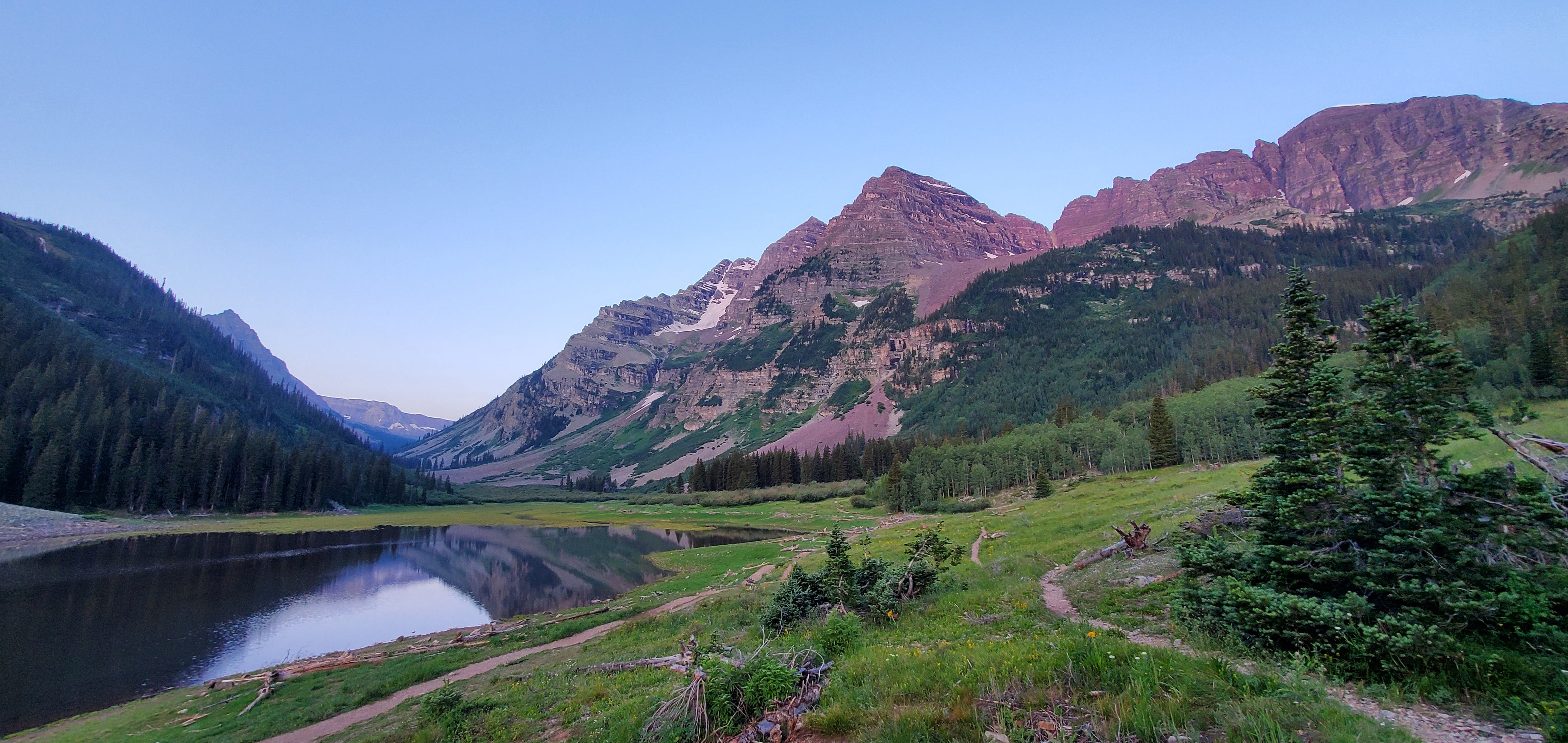
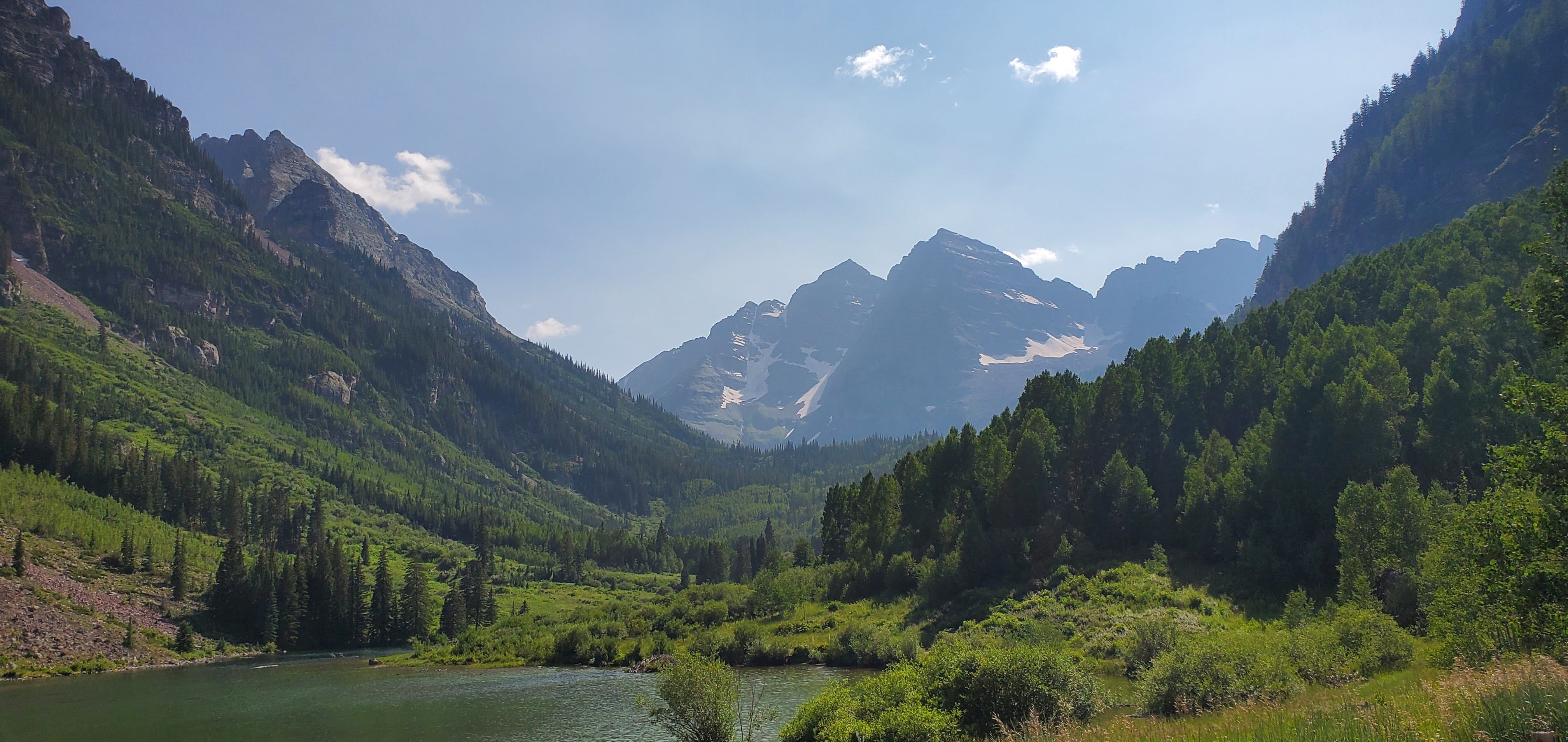
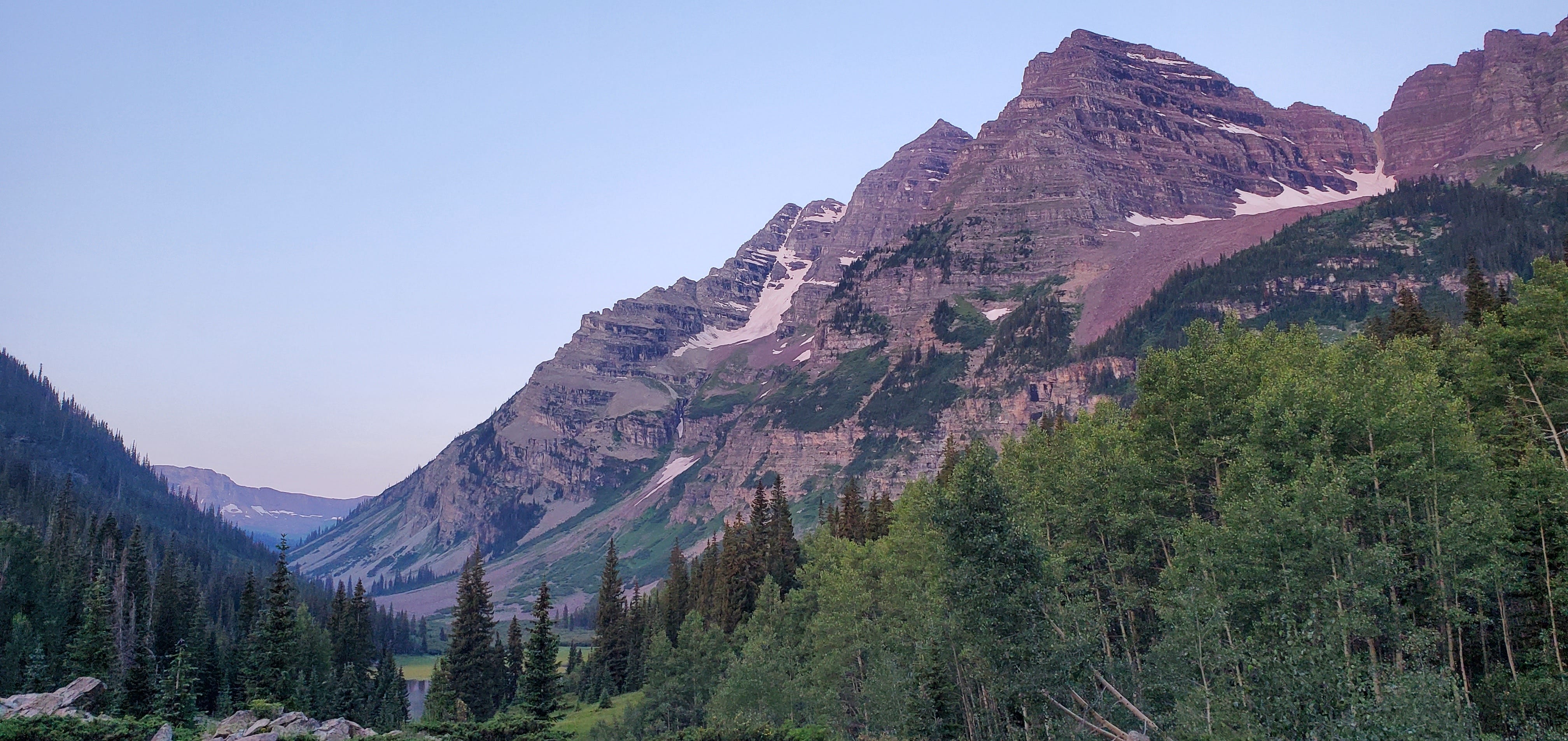
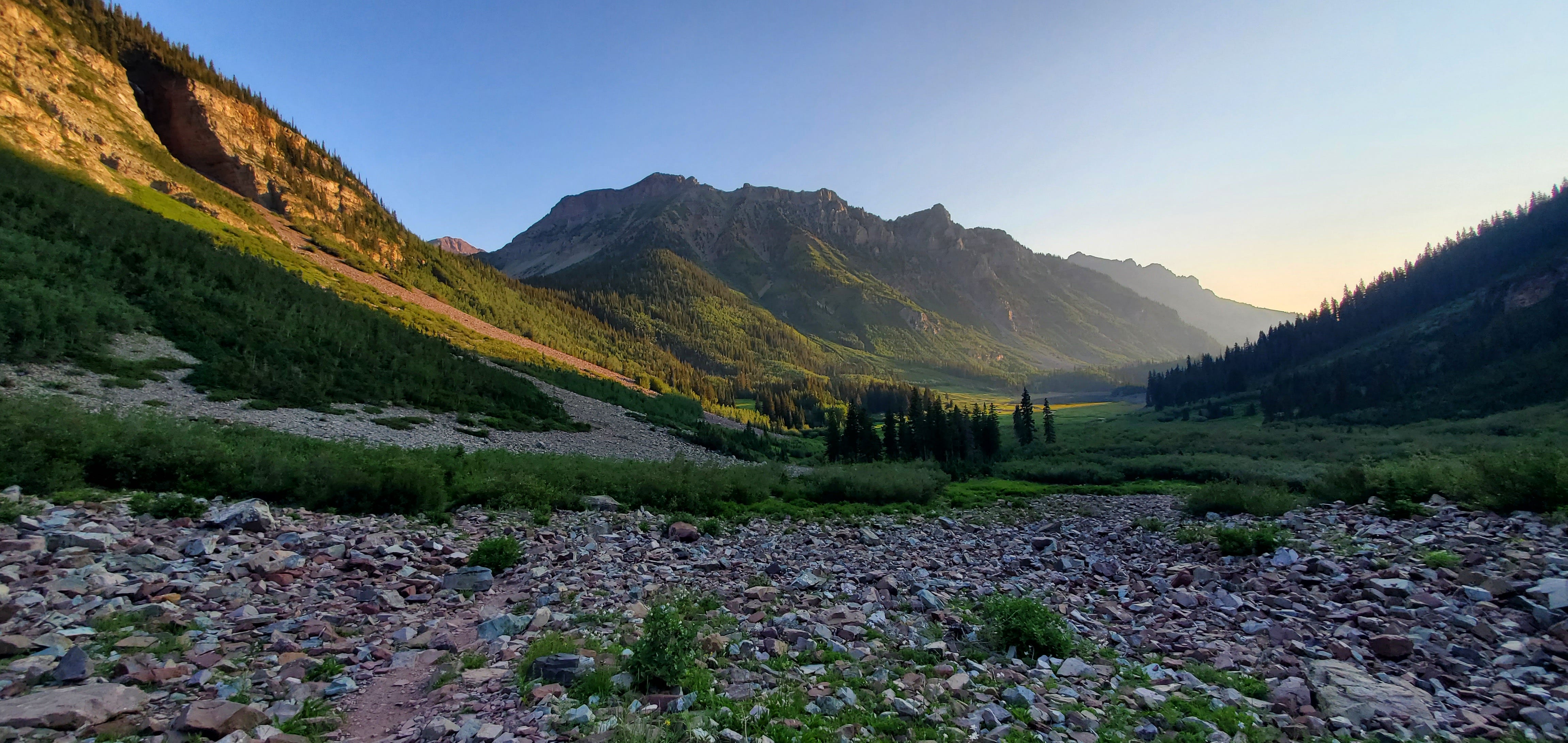
At some zero dark thirty hour I decided to start waking up and review the beta and images for my trip. To my dismay, I realized that they had not properly saved to my phone and that I didn't have anything besides a portion of the mapping file stored. Attempting to find some service, I drove around and could only get one bar, which wasn't enough to connect to the website I needed, and I was unwilling to drive all the way back into town. A voice in my head was starting to scream, "Call it off!" As I sat in my truck hoping that the one bar of service would miraculously turn into full 5G, a fox sauntered across the road in front of me. Living its life in the present moment, it was not concerned one bit by the lack of internet or the general woes of man or myself. Though unassailed and unburdened by the issues afflicting me, I still found the fox to be a good omen. This cunning survivor served as a reminder that my ancestors, just like the fox's, had a set of skills that allowed them to thrive in the wilderness without any conveniences and surely some of that must have been bestowed upon me, right? I'd take a boost of confidence wherever available and decided to use this furry comrade as a source of courage. Weighing my options, I considered waiting till daylight just to get some extra rest and have an easier time along my path, but I knew well that miles must be made in the dark in order to have a chance of avoiding the often unpredictable summer thunderstorms. Having nearly been struck by lightning above tree line before, it was not a situation I cared to repeat. So, hesitant and beleaguered, I mustered a dim sense of undaunted fortitude, donned my pack and struck out into the blackness of predawn. Passing under the Bells in darkness, I could only distinguish their hulking silhouettes. It was unfortunate to miss the postcard picture view of them from Maroon Lake, but the sacrifice would be worth it.
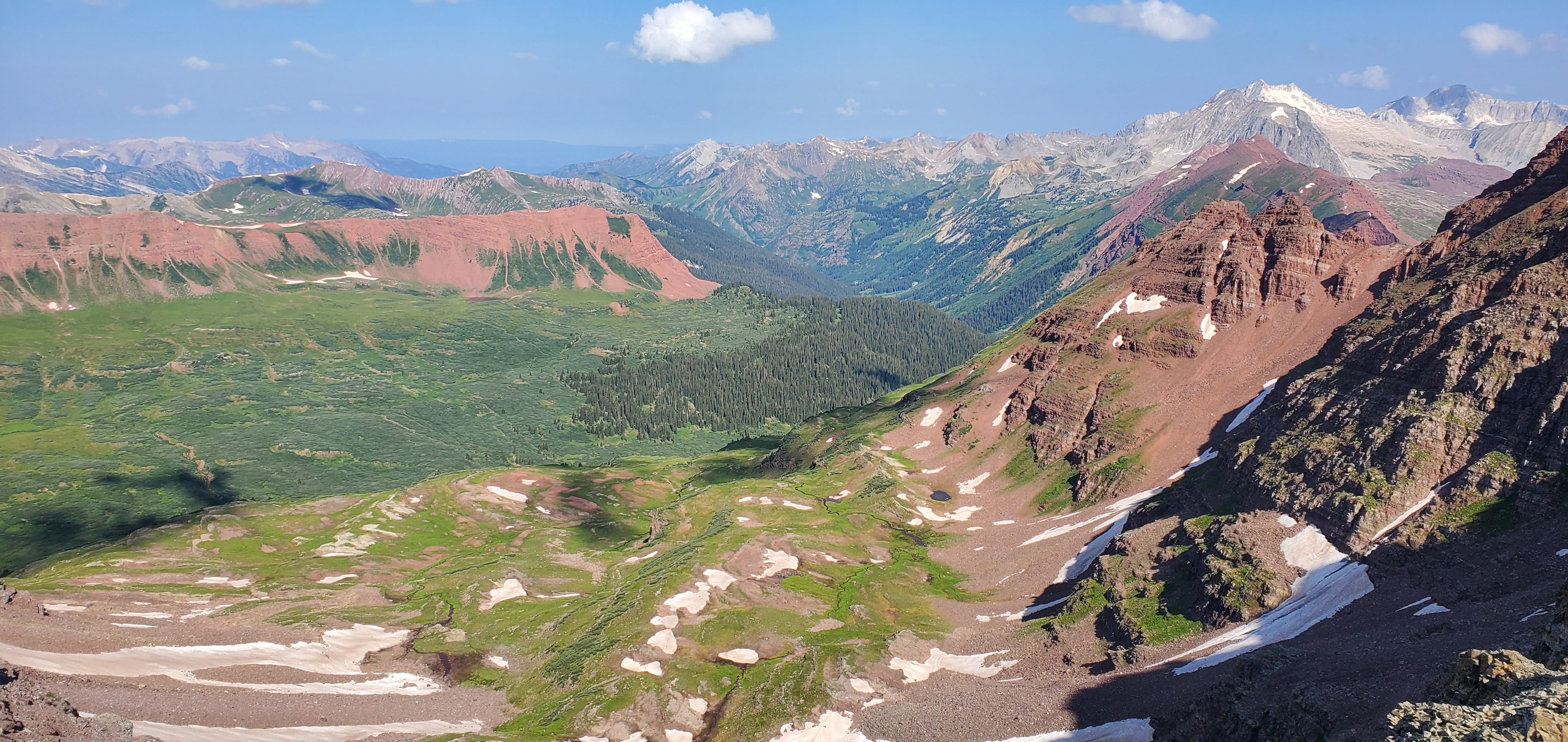
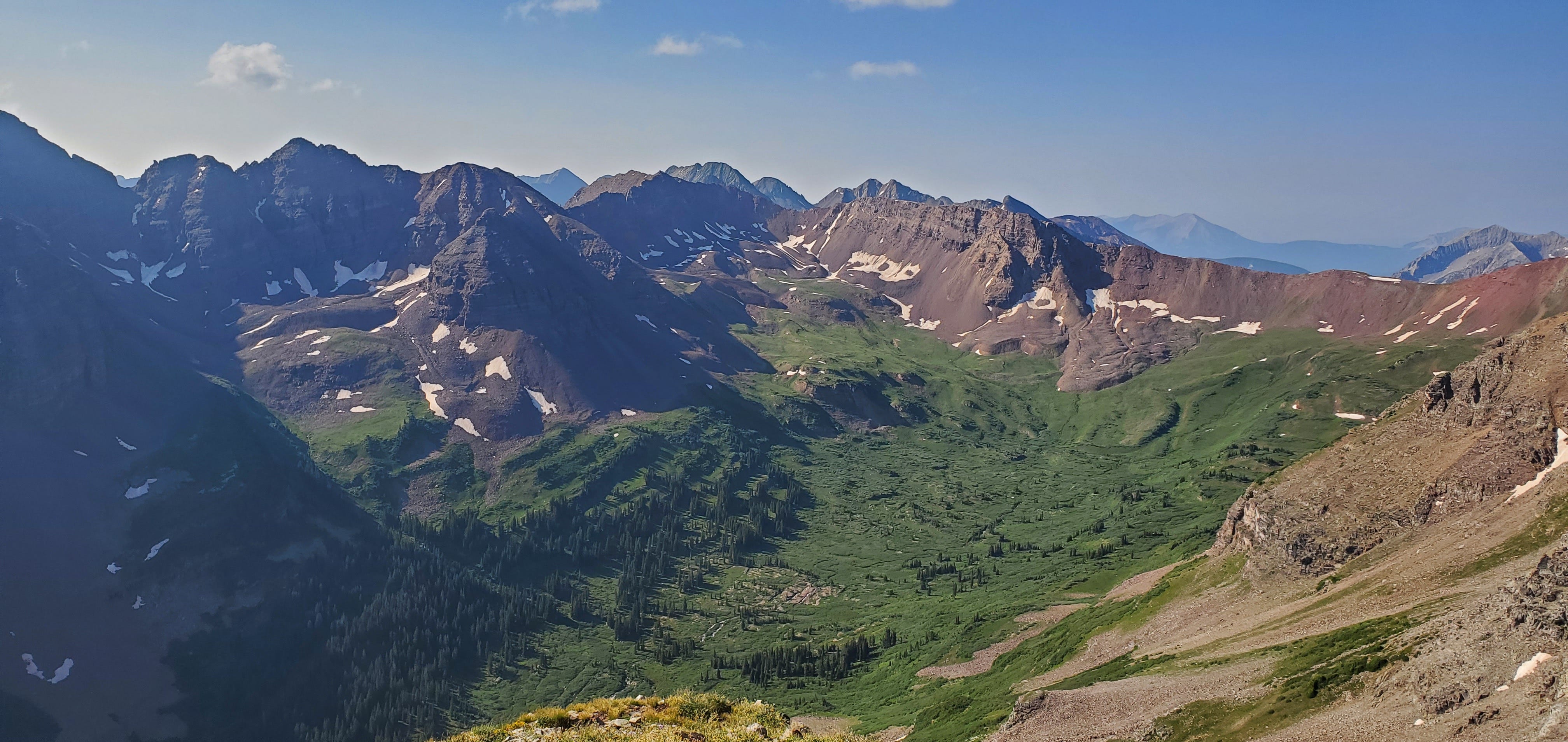
For about the first few miles or so the route follows along a maintained trail, well trodden by many visitors. Eventually, you will pass a cairn marking the turn from the cultivated to the less than beaten path. A cairn so indistinct I walked right past it. Though I made that excusable error, severe punishment was held at bay as I was keeping a good eye on my map and only had to backtrack slightly to find my way to the proper place to begin the journey up Maroon Peak. The base starts out gently enough and then the grade and trail conditions start to give one something to make them consider their life choices. Referred to as the, "2800 feet of suck," the ascent took two times as long as I had anticipated. To be fair, I hadn't really researched this section as much as I could have, putting most of my focus into the hard route, finding and assuming that any of the complaints about difficulty in this section were probably from the unprepared. Steep grades and loose earth underfoot made keeping a stout pace difficult and I allowed myself to feel a bit humbled. With the sun rising I was starting to be treated to magnificent views and psychedelic colors which helped me keep my head up and wipe the sweat from my brow in defiance. Pyramid peak and its sub summits, Thunder and Lightning Pyramid, felt like they were so close one could practically jump across the void between.
Though somewhat tricky, I was able to remember much of the notes about route finding on this side of the peak, and along with the aid of a few generous cairns along the way, I eventually found myself at the summit. Chalk it up to some favor from fortune being bestowed on the somewhat prepared mind. There were actually a couple of folks at the top, which I wasn't expecting. Two of the men had come from the other side, meaning they had already completed the traverse that morning. And I thought I got an early start, but more than likely they had begun from the campsites whereas I had started from the parking lot farther below. The fellas who had done the traverse were fairly nonchalant about it, but confirmed that the 5th class sections were not underrated. Checking my phone I could see that I had service and decided to download all the pictures and a different map to help with the far trickier and dangerous sections of the path that lay ahead. It's not even a half mile between the two peaks, but there are numerous obstacles that can be nearly impassable and downright dangerous if one does not pick the appropriate lines of descent and ascent. My concern about the pictures is humorous now because I didn't end up using them at all and yet nearly bailed on the trip because I didn't have them. The map, on the other hand, proved invaluable.
To be continued…